Old Testament Maps
Related Links:
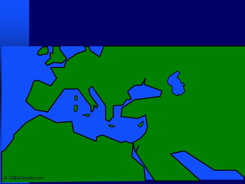 |
Bible Lands Overview Keywords: |
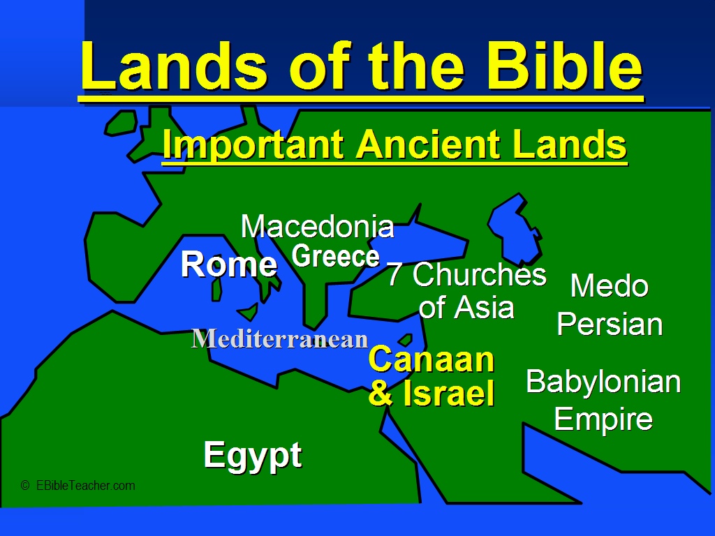 |
Important Ancient Lands Keywords: |
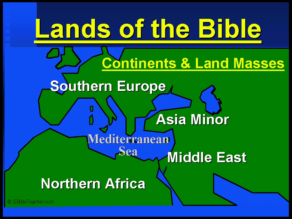 |
Continents & Land Masses Keywords: |
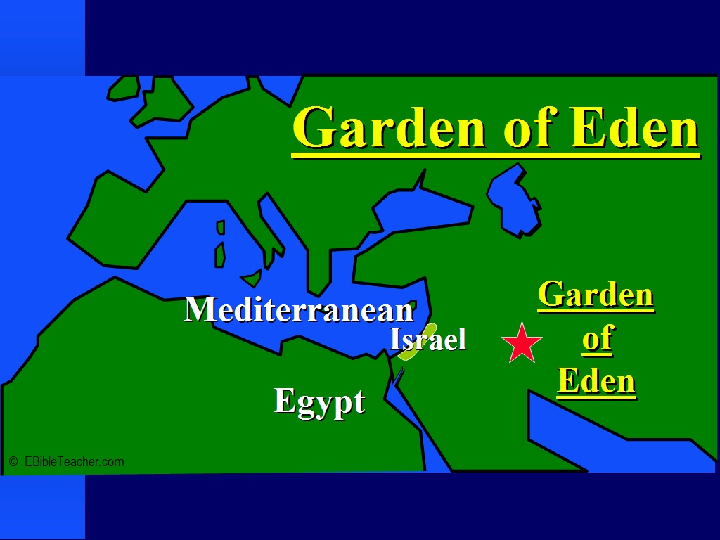 |
Garden of Eden Although we do not know the exact location of the Garden of Eden we do know that the Tigris and Euphrates rivers are found in the countries of Iraq & Iran and thus near the Garden of Eden. Tradition has located Eden south of the ancient city of Ur in Iraq. Some people believe that the names have changed and that the Garden of Eden was really located in the land of Egypt between the Blue and White Nile rivers. Keywords: Garden of Eden, Iran, Iraq |
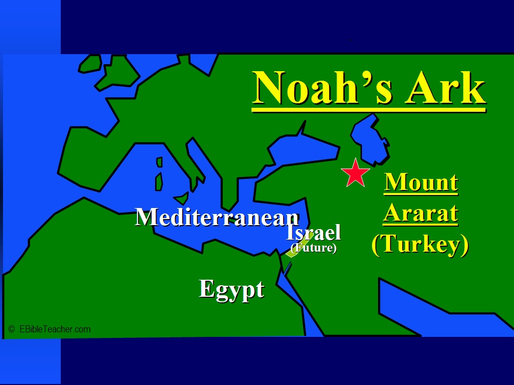 |
Noah's Ark 1 Keywords: Mount Ararat, Noah's Ark |
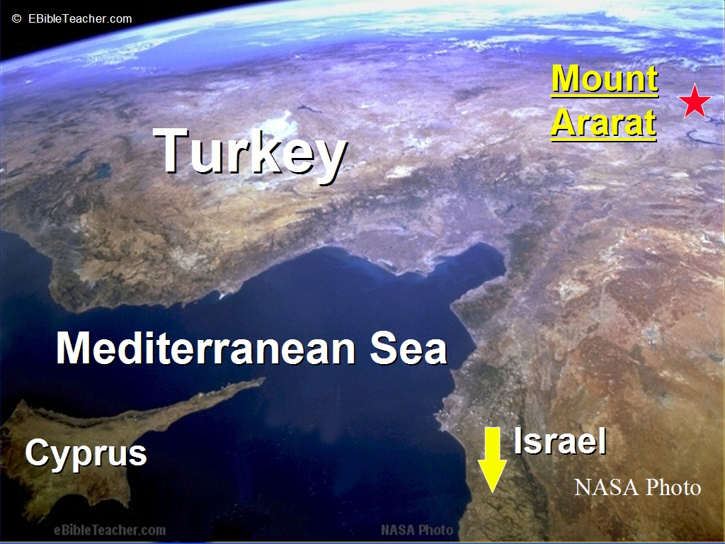 |
Noah’s Ark 2 Keywords: Mount Ararat, Noah's Ark Source: NASA |
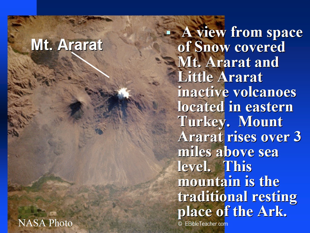 |
Noah’s Ark/Mt. Ararat The picture shows a satellite view of snow covered Mt. Ararat and Little Ararat. These mountains are inactive volcanoes located in eastern Turkey. Mt. Ararat rises over 3 miles above sea level. This mountain is the traditional resting place of the Ark. You can see the lava flow fields to the south part of the mountain peak. Below the lava field you can see green fields. Keywords: Mount Ararat, Noah's Ark Source: NASA |
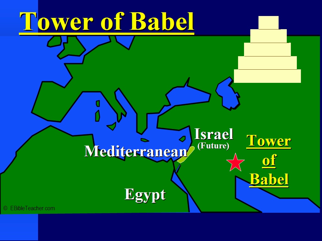 |
Tower of Babel Keywords: Tower of Babel |
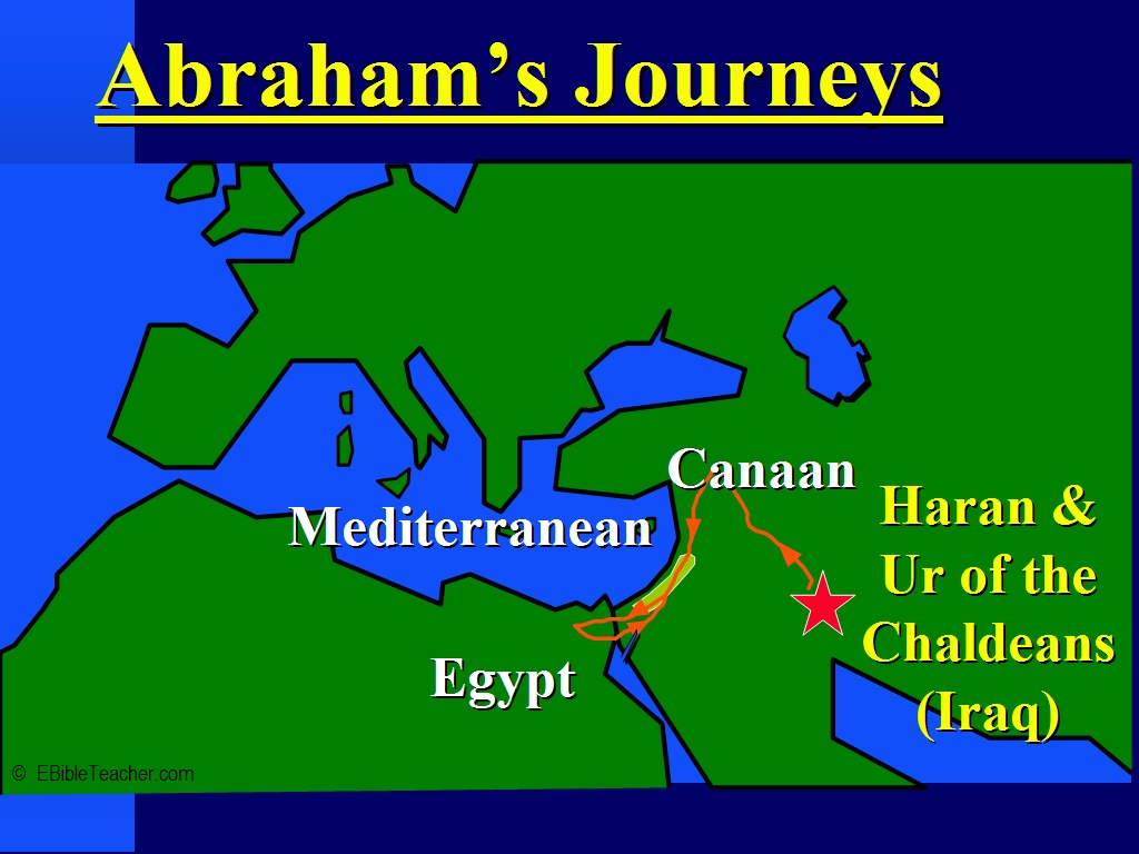 |
Abraham’s Journey Keywords: |
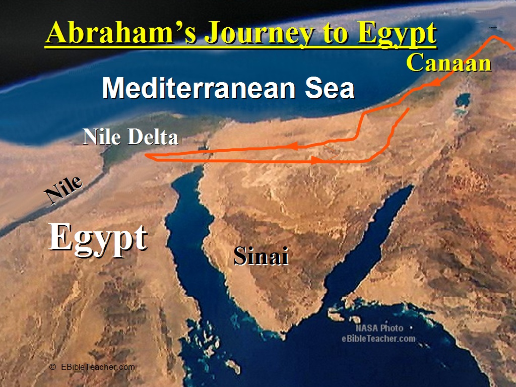 |
Abraham Journey to Egypt Keywords: Abraham, Egypt Source: NASA |
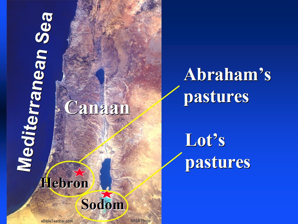 |
Abraham in Canaan Keywords: Abraham, Canaan Source: NASA |
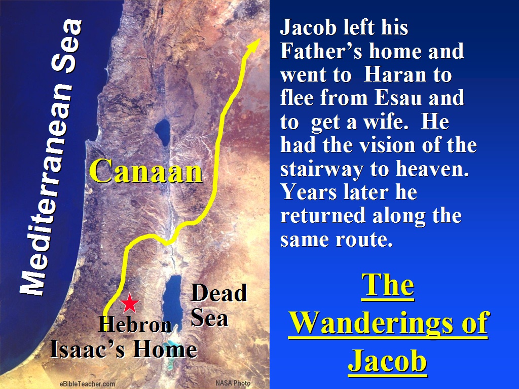 |
Wanderings of Jacob Keywords: Canaan, Jacob Source: NASA |
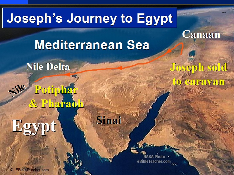 |
Joseph's Journey to Egypt The photo of Joseph’s family journey into Egypt shows the fertile Nile delta as the Nile empties into the Mediterranean Sea. During the famine, this became the home of the Israelites. Keywords: Egypt, Joseph Source: NASA |
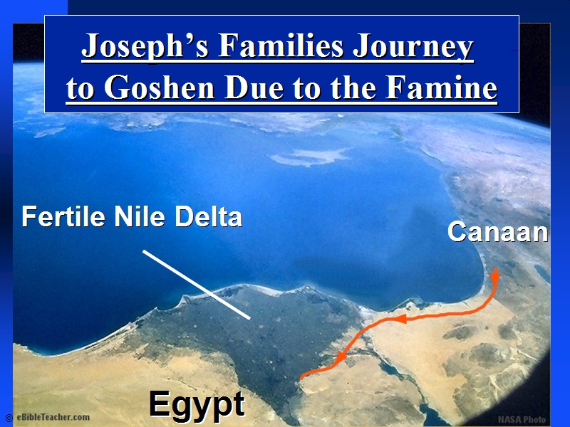 |
Joseph's Family to Goshen Keywords: Goshen, Joseph Source: NASA |
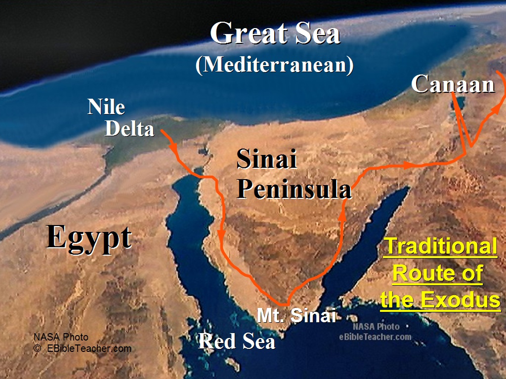 |
Route of the Exodus Keywords: Canaan, Egypt, Exodus, Sinai Source: NASA |
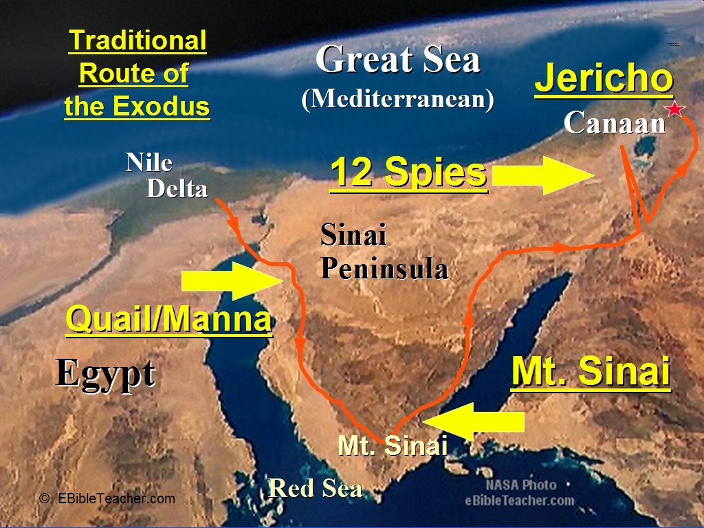 |
Exodus Major Events Map The slide shows the traditional route of the Exodus. Some say that this route went through the land of Midian that Moses had become familiar with when he fled to the land of Midian to avoid the prosecution for killing the Egyptian. The more popular route to Canaan was the northern route along the Mediterranean. That route had a variety of Egyptian military posts which would likely have resulted in many conflicts with the remaining Egyptian army units that had been detailed to these outposts. Keywords: Exodus Source: NASA |
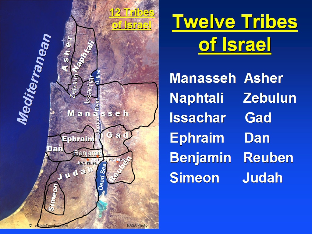 |
Twelve Tribes of Israel Keywords: Israel Source: NASA |
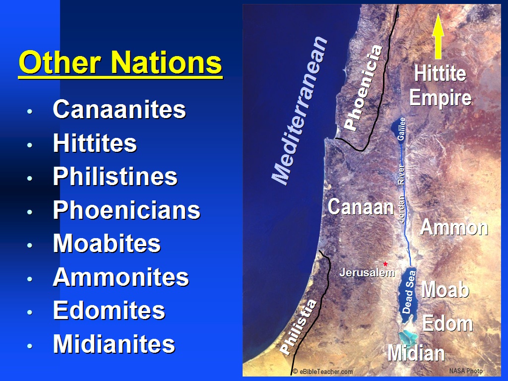 |
Nations of Canaan Keywords: Canaan Source: NASA |
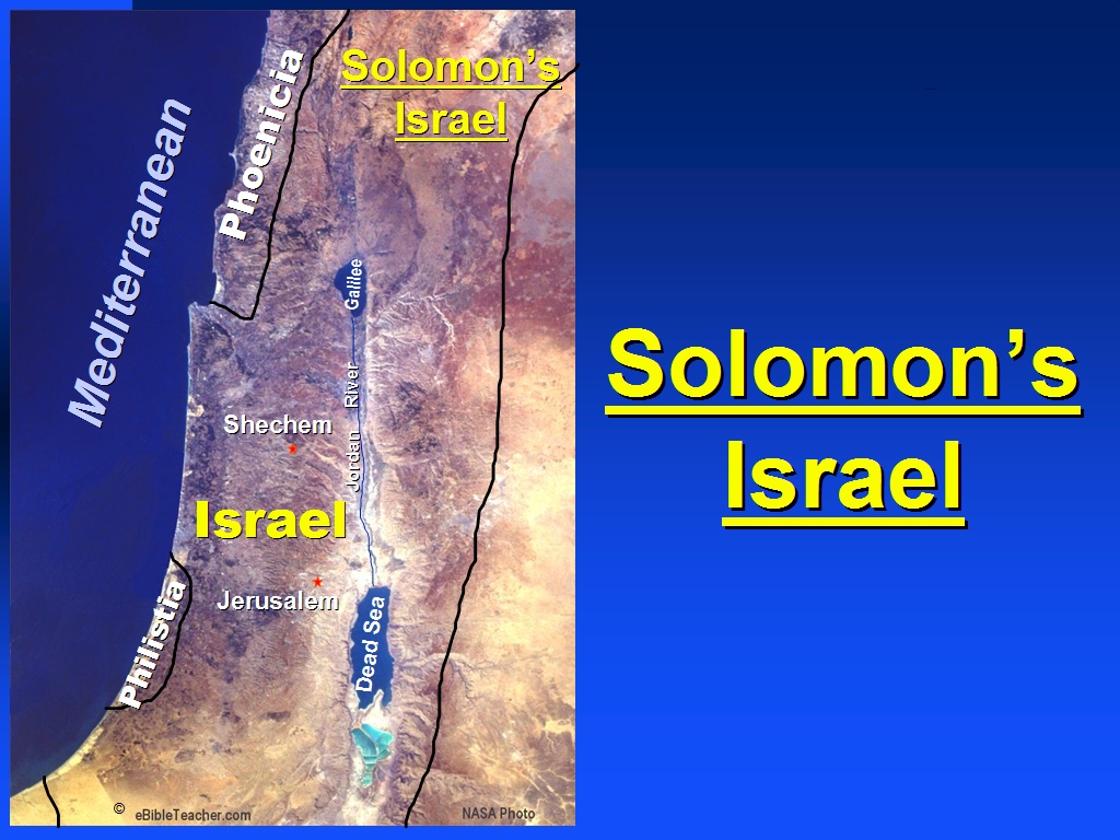 |
Solomon's Israel Solomon's Israel was the period in which Israel was at its greatest. Solomon's Israel was so large that it can’t all be shown on this NASA photo. Keywords: Israel, Solomon Source: NASA |
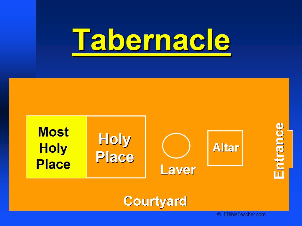 |
Tabernacle 1 The Tabernacle outer wall surrounding the courtyard was about 150 by 75 feet or about 50 by 25 meters. (An American football field is 300 by 75 feet). The outer linen wall was held up by wooden posts with bronze bases and silver tops. The linen was white except at the entrance door which was purple and blue and scarlet colors. Just inside the outer wall door was the altar of burnt offering which was made of wood overlaid with bronze. The alter was about 7.5 feet square (2.5 meters). Next came the laver which was a large bronze basin used by the priests to wash before entering the tabernacle. The Tabernacle tent itself was over a frame of acacia wood. The wood was overlaid with gold which created two golden walled rooms within the tent. The tent coverings were 4 layers thick of blue, purple, scarlet tapestry on the inside layer covered with goats hair cloth, followed by a waterproof covering of ram’s skins dyed red and finally an outer layer of fine waterproof leather. The Tabernacle was divided into two rooms. The first room was the Holy place in which was the Menorah, Altar of Incense and Table of Shewbread and the second room was the “Most Holy Place” or sometimes called the “Holy of Holies” in which was the Ark of the Covenant. The High Priest was only allowed to enter this room once per year. The two rooms were separated by a double curtain. Keywords: Israel, Tabernacle |
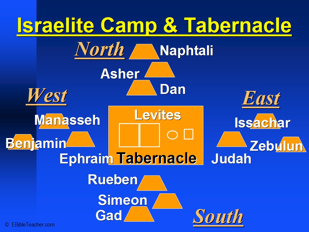 |
Tabernacle 2 ISRAELITE CAMP AND TABERNACLE SCHEMATIC: This slide shows how the Tabernacle occupied a position at the center of the camp with the 12 tribes of Israel arranged in specific locations around the Tabernacle. There were three tribes camped at each point of the compass around the Tabernacle. The Levites occupied a camp immediately surrounding the Tabernacle. Keywords: Israel, Tabernacle |
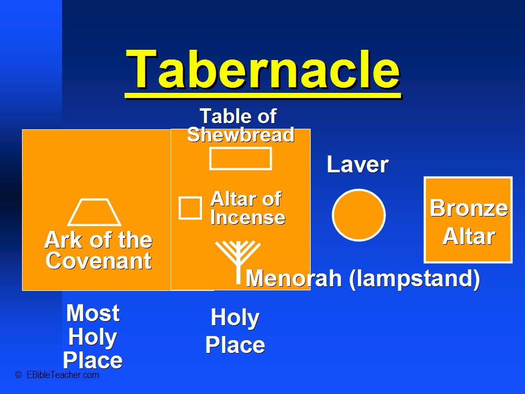 |
Tabernacle 3 Just inside the outer wall door was the altar of burnt offering which was made of wood overlaid with bronze. The alter was about 7.5 feet square (2.5 meters). Next came the laver which was a large bronze basin used by the priests to wash before entering the tabernacle. The Tabernacle tent itself was over a frame of acacia wood. The wood was overlaid with gold which created two golden walled rooms within the tent. The tent coverings were 4 layers thick of blue, purple, scarlet tapestry on the inside layer covered with goats hair cloth, followed by a waterproof covering of ram’s skins dyed red and finally an outer layer of fine waterproof leather. The Tabernacle was divided into two rooms. The first room was the Holy place in which was the Menorah, Altar of Incense and Table of Shewbread and the second room was the “Most Holy Place” or sometimes called the “Holy of Holies” in which was the Ark of the Covenant. The High Priest was only allowed to enter this room once per year. The two rooms were separated by a double curtain. Keywords: Israel, Tabernacle |
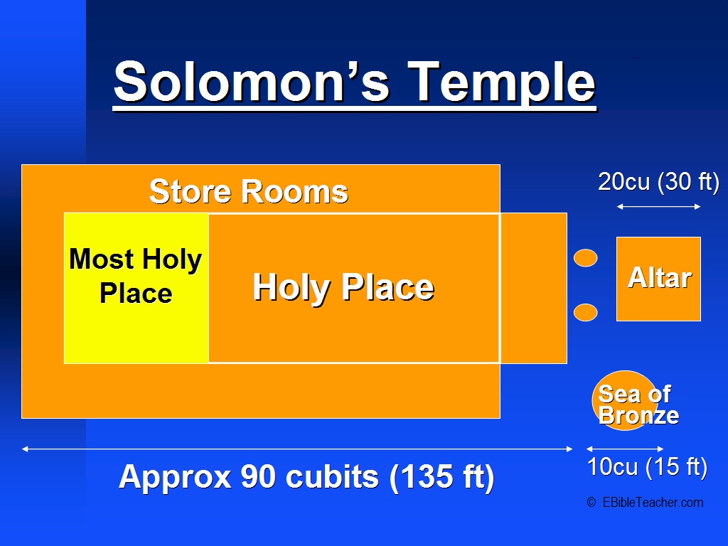 |
Solomon's Temple Keywords: Solomon, temple |
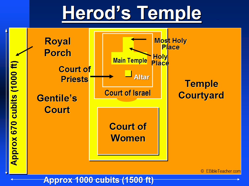 |
Herod's Temple A graphic map of Herod's Temple, including the many courts and out-buildings mentioned in the Bible. Keywords: Herod, temple |
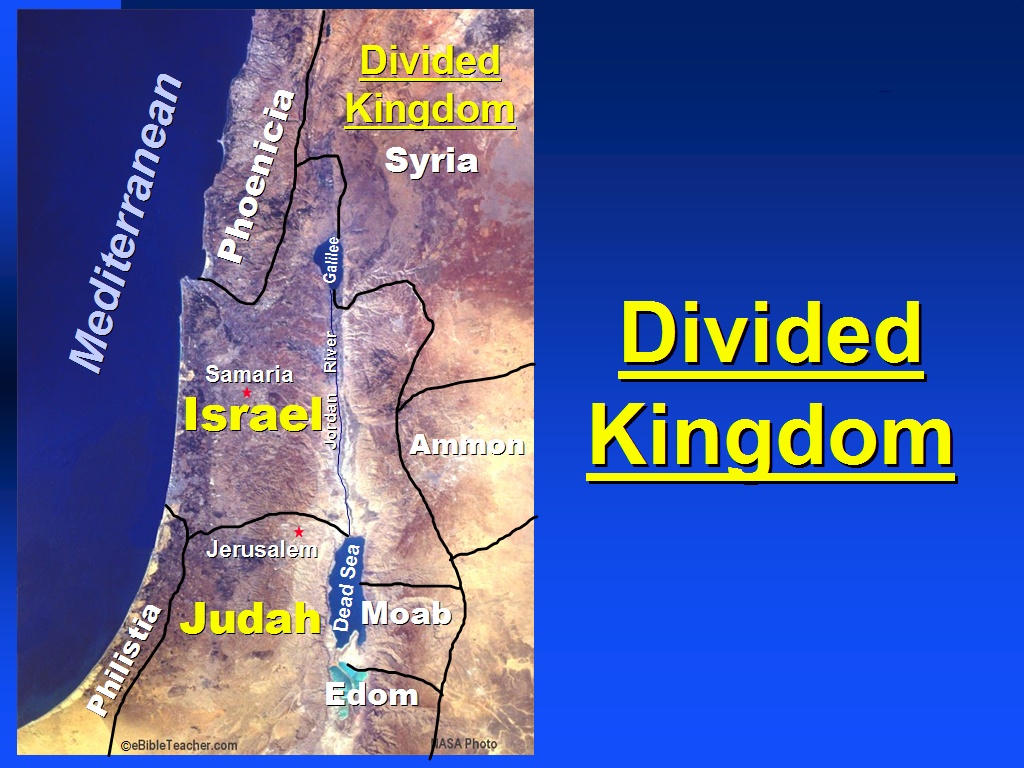 |
Divided Kingdom After Solomon's reign his kingdom was divided into two parts. Keywords: Israel, Judah, Solomon Source: NASA |
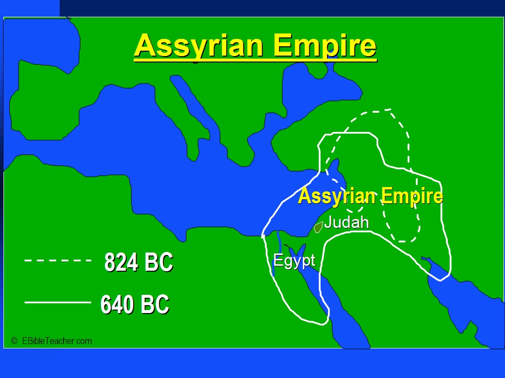 |
Assyrian Empire Assyria was based in what is now the northern part of Iraq. The Assyrian empire became an important empire between 1500 and 1100 BC and lasted until conquered by Babylon in about 600 BC. A few hundred years later the Assyrian empire came and overwhelmed the Israelite nation. The Assyrians liked to take large numbers of the conquered people back to other parts of the empire and then replacing them with people from other countries. That this happened in 2Kings 17:6, 24+ and 2Kings 18:31-32. Tiglath-pileser III conquered Israel and oppressed Judah. Judah was made to pay tribute. When Judah rebelled the Sennacherib the king of Assyrian came in and conquered Judah but left Jerusalem alone. The religion of Assyria was very similar to that of the Babylonians. Keywords: Assyria, Assyrian, Empire, Iraq, Israel |
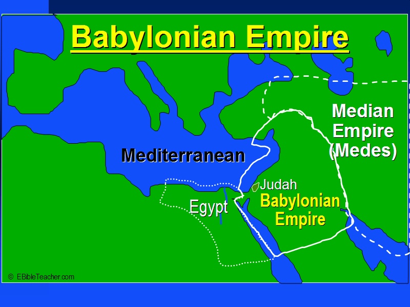 |
Babylonian Empire Babylon was based in what is now the southern part of the country of Iraq. Babylon was first an important power in about 1850 BC and then later in about 650 BC when they overcame the Assyrian empire. Although the oldest known alphabet comes from the Canaanites, the oldest known writing comes from the Babylonians. Keywords: Babylon, Babylonian, Empire, Iraq |
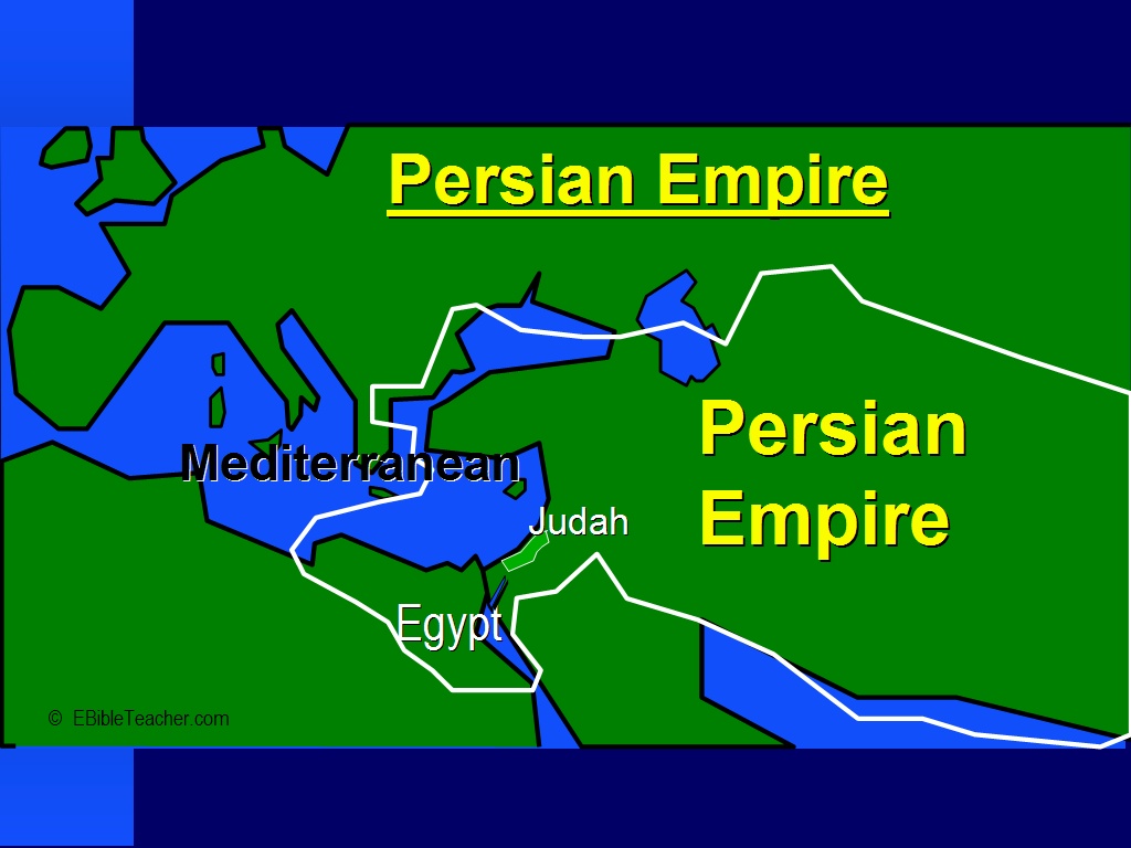 |
Persian Empire The Persian empire first became prominent about 550 BC when King Cyrus conquered the Babylonian empire. Daniel was in exile in Babylon when the Persians conquered that city. Cyrus allowed many Jews to return to their homeland. Esther became queen to king Xerxes I. The Jews were allowed to take back many temple treasures and rebuild the temple as described in the stories of Exra and Nehemiah. The Persians controlled lands from Egypt to as far as India and as far north as modern day Turkey. They held their empire for about 200 years. In 333 BC, Alexander the great defeated them. Persian religion was based on the life of a herdsman. Keywords: Empire, Persia, persian |