New Testament Maps
Related Links:
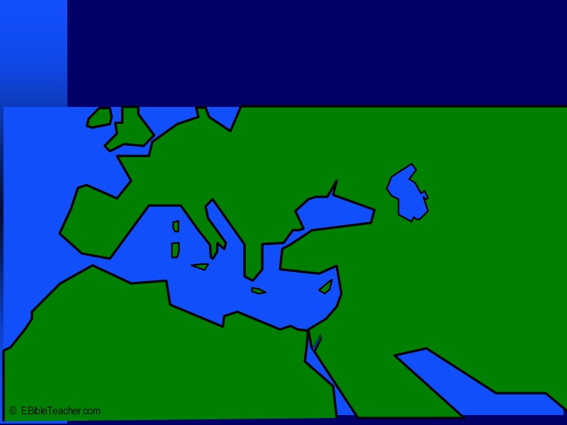 |
Bible Lands Overview Keywords: |
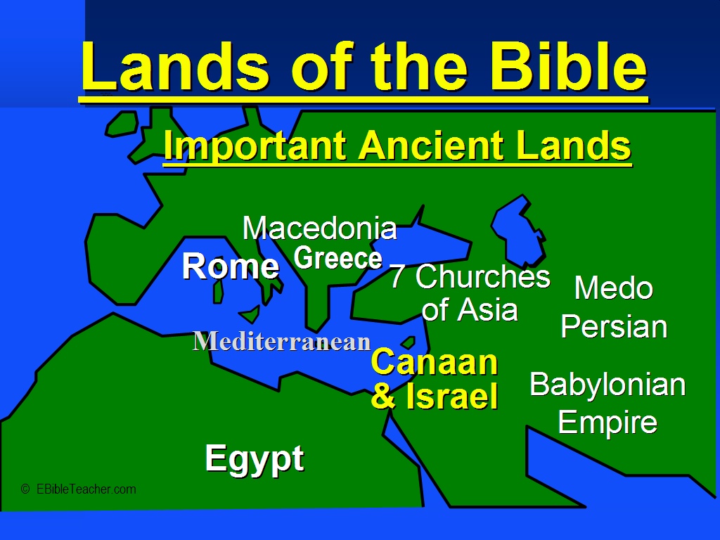 |
Important Ancient Lands Keywords: |
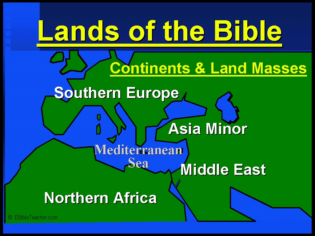 |
Continents & Land Masses Keywords: |
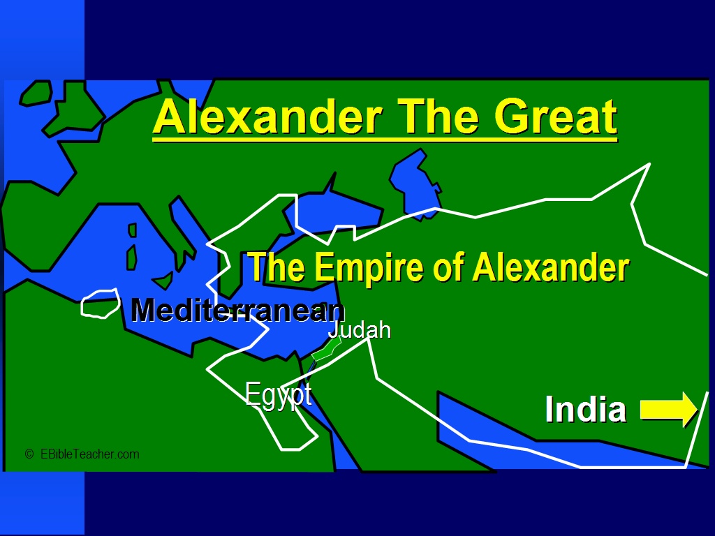 |
Alexander the Great Although Alexander the Great is not mentioned in the Bible. The effects of his empire made great impact on the New Testament. Greek became the language of business and ultimately the language that the New Testament was written in. Keywords: |
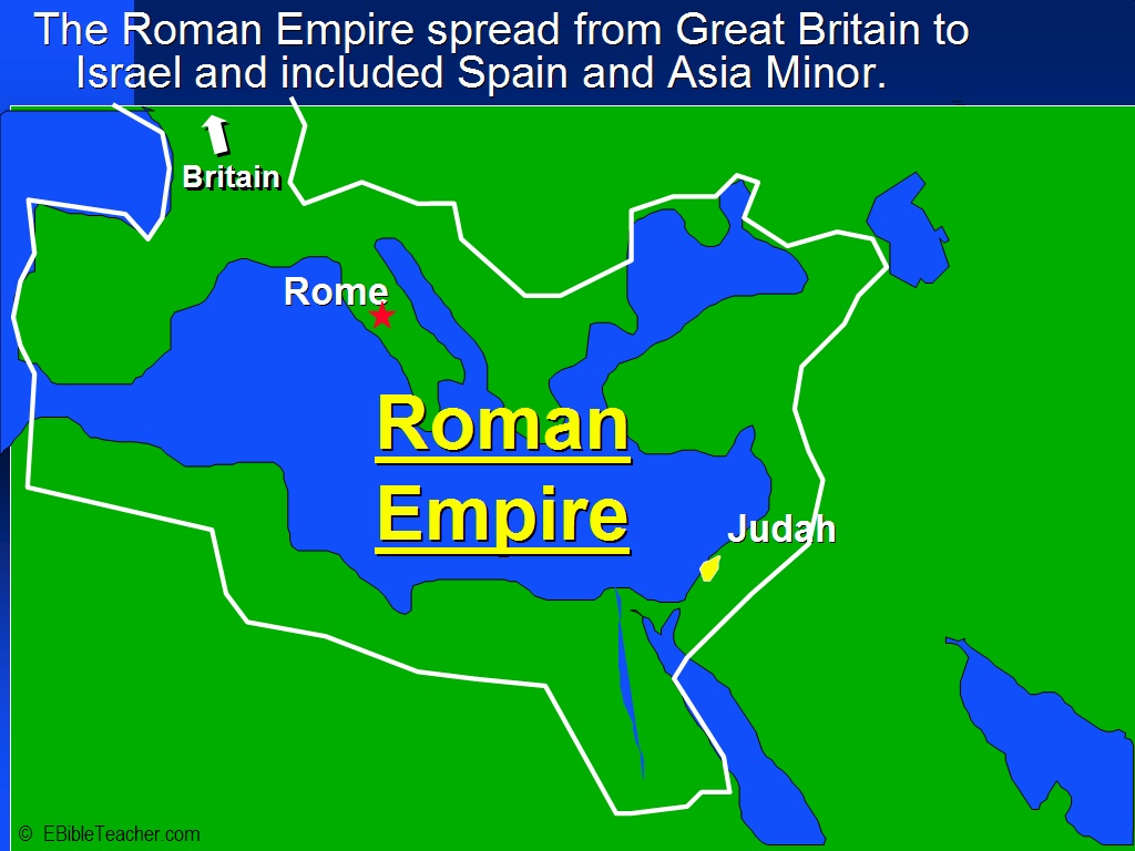 |
Roman Empire The Roman empire was in control of much of the world during the time of Christ. The empire helped in the spread of Christianity by providing a highway system and relatively safety. Keywords: |
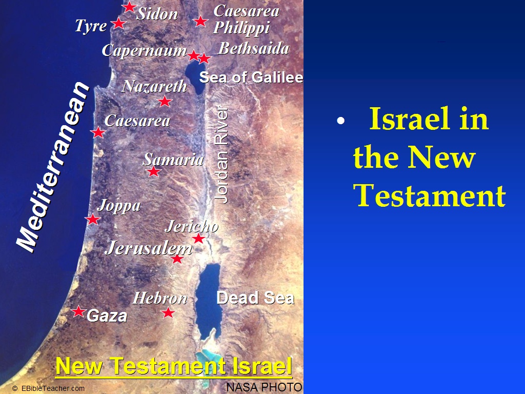 |
Israel in the New Testament Note that the land is no longer divided by tribes. The people, however kept detailed records of their lineage and could easily describe from what tribe they had descended. This was particularly important in regards to determining who could serve as priest. Only descendants of the tribe of Levi were allowed to serve as priests. Keywords: Source: NASA |
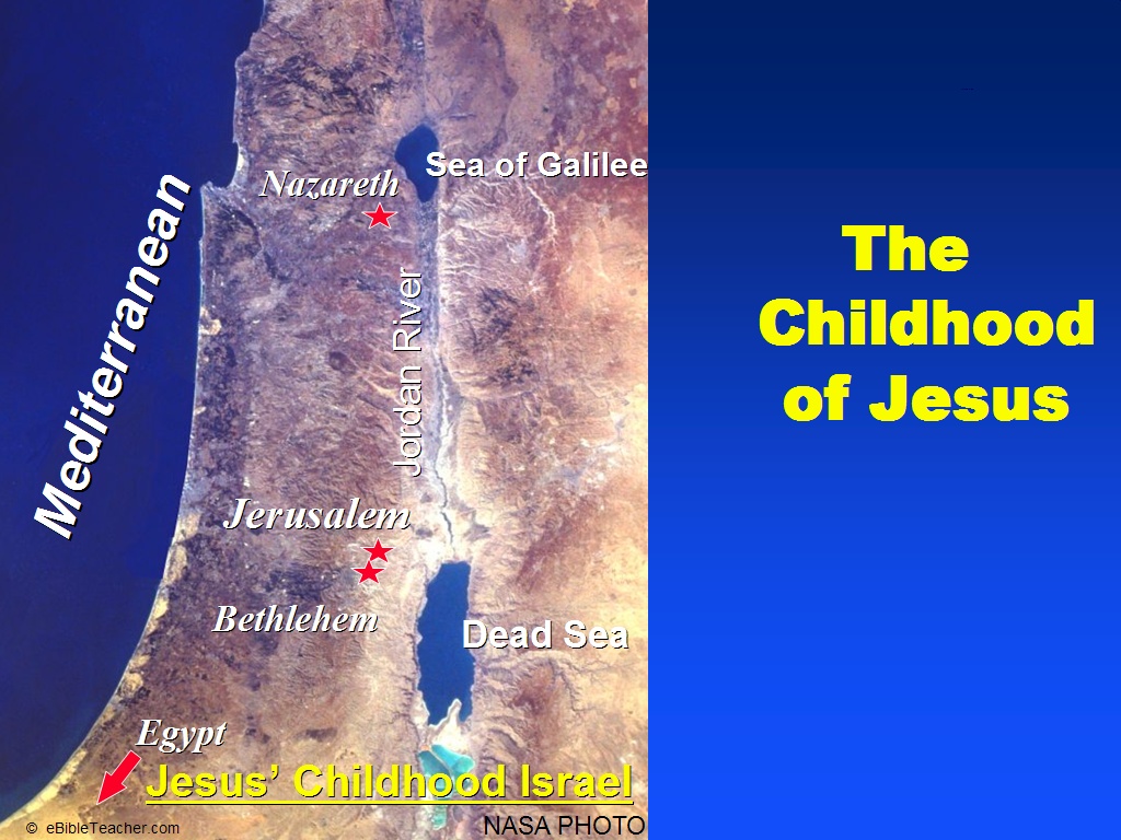 |
Childhood of Jesus The known travels of Jesus as a child included, Bethlehem, Jerusalem, Egypt and Nazareth. Keywords: Bethlehem, Egypt, Jerusalem, Nazareth Source: NASA |
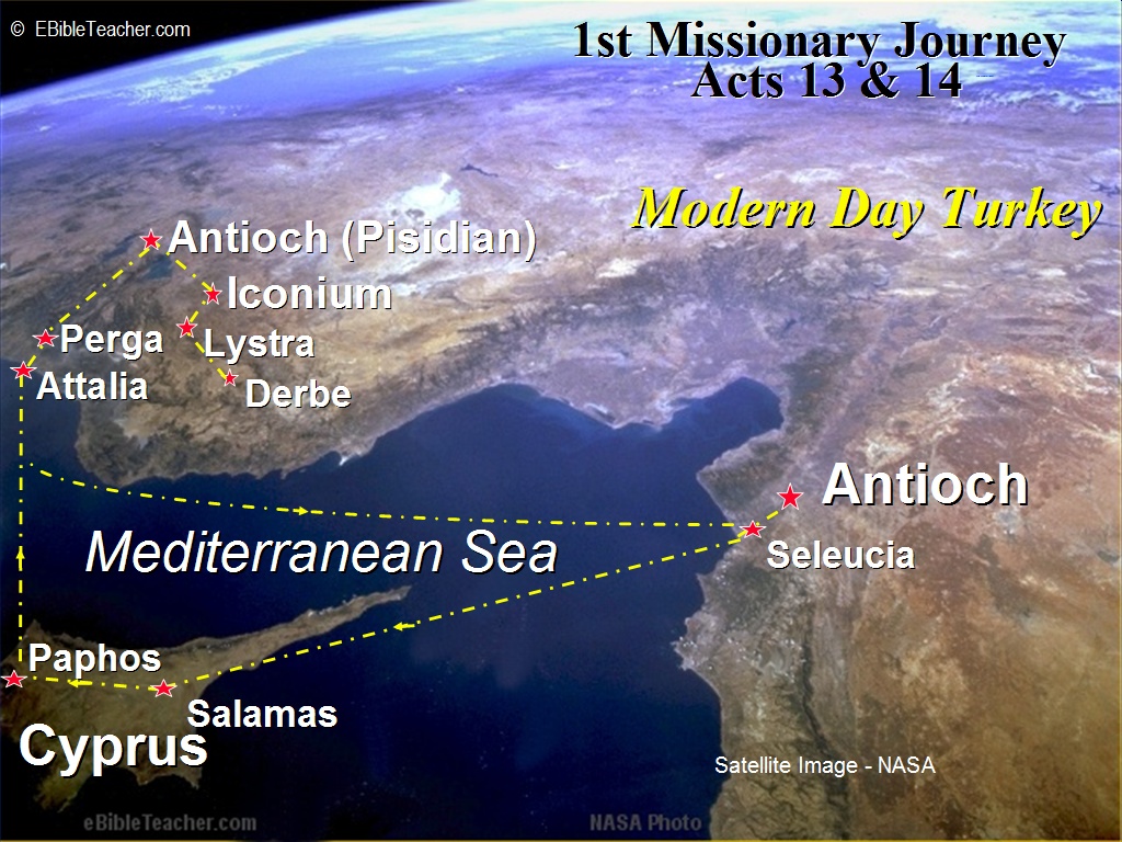 |
Paul's 1st Missionary Journey This shows the first missionary journey of Paul as described in Acts chapters 13 and 14. Keywords: Paul Source: NASA |
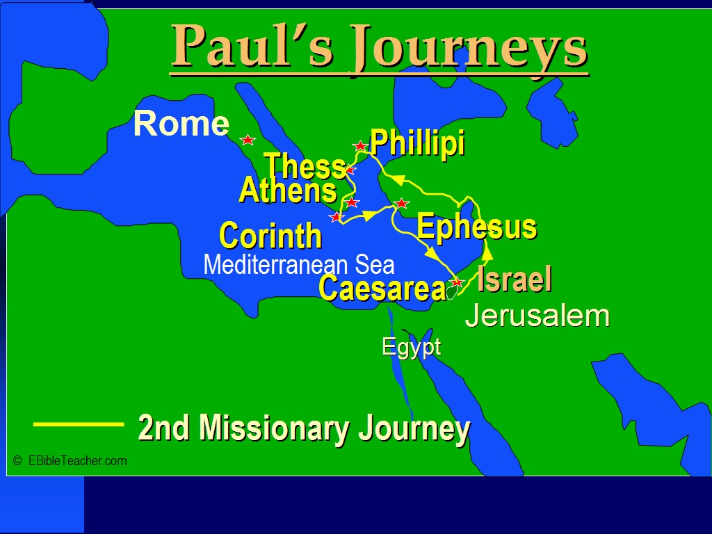 |
Paul's 2nd Missionary Journey This map shows Paul’s 2nd missionary journey as described in Acts chapter 15:36 - 18:22. The cities of Philippi, Ephesus, Corinth and Thessalonica were later sent letters by Paul. Keywords: Paul |
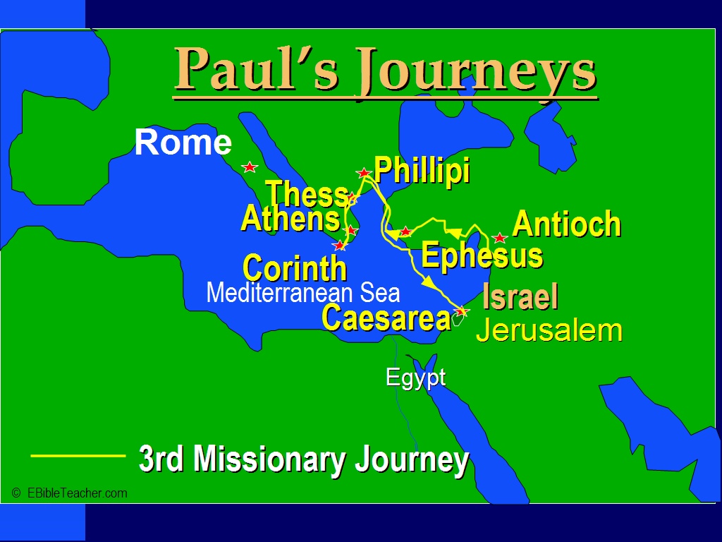 |
Paul's 3rd Missionary Journey Paul’s third missionary journey was written of in Acts 18:23-21:26. In this journey he revisited many of the cities that he had previously gone to. Keywords: Paul |
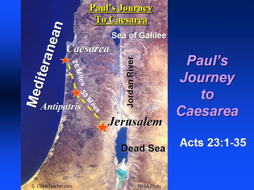 |
Paul to Caesarea Keywords: Caesarea, Paul Source: NASA |
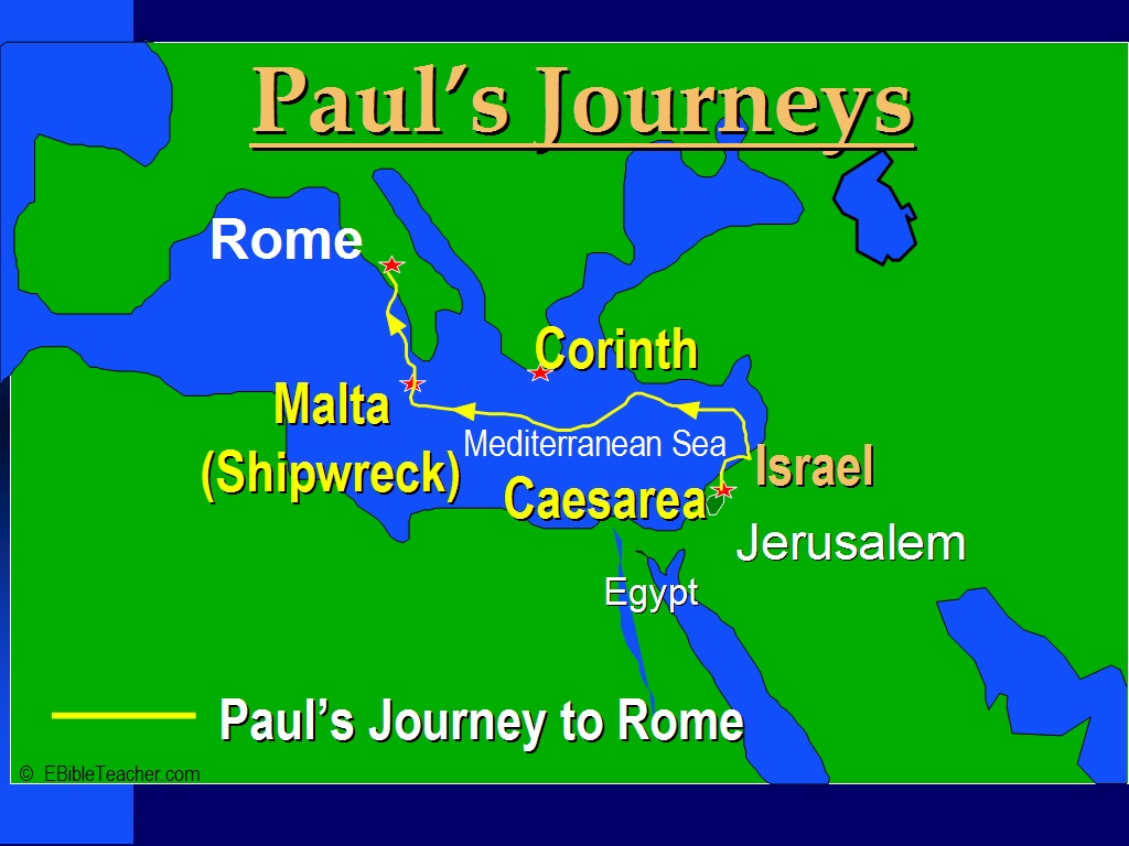 |
Paul's Journey to Rome Paul's journey to Rome is described in Acts chapters 27 and 28. Keywords: Paul, Rome |
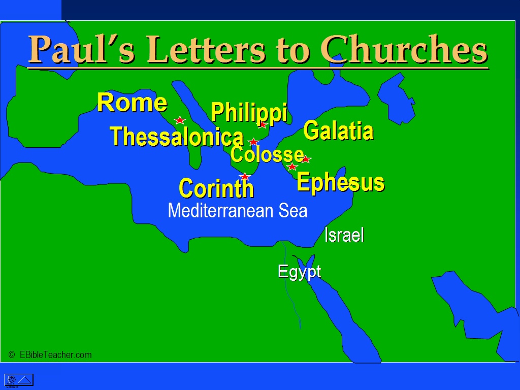 |
Paul- Letters to Church Keywords: Paul |
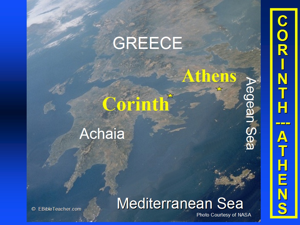 |
Corinth/Athens Keywords: Athens, Corinth Source: NASA |
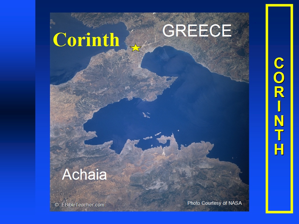 |
Corinth, Greece Paul’s journeys to Corinth and Athens were described in Acts 17 and 18. We have two letters that Paul sent to Corinth in the letters of 1st & Second Corinthians. Keywords: Corinth, Greece Source: NASA |
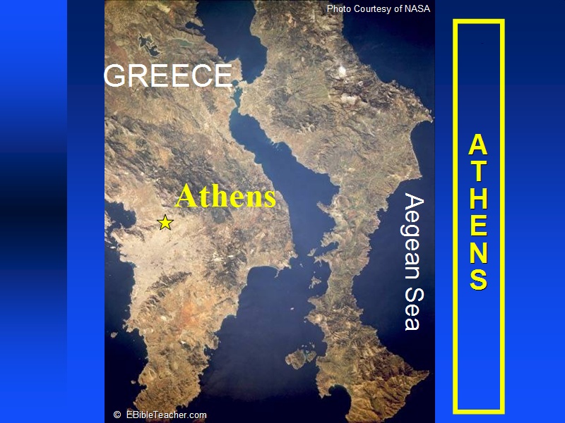 |
Athens, Greece Paul’s journeys to Corinth and Athens were described in Acts 17 and 18. We have two letters that Paul sent to Corinth in the letters of 1st & Second Corinthians. Keywords: Athens, Greece Source: NASA |
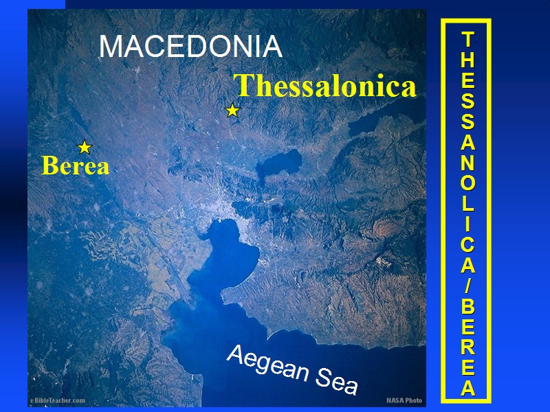 |
Thessalonica/Berea Keywords: Berea, Thessalonica Source: NASA |
 1024.JPG) |
Seven Churches of Asia in Revelation The seven churches of Asia were written to in the book of Revelation in Revelation chapters 2 and 3. Keywords: Revelation, seven churches of asia Source: NASA |
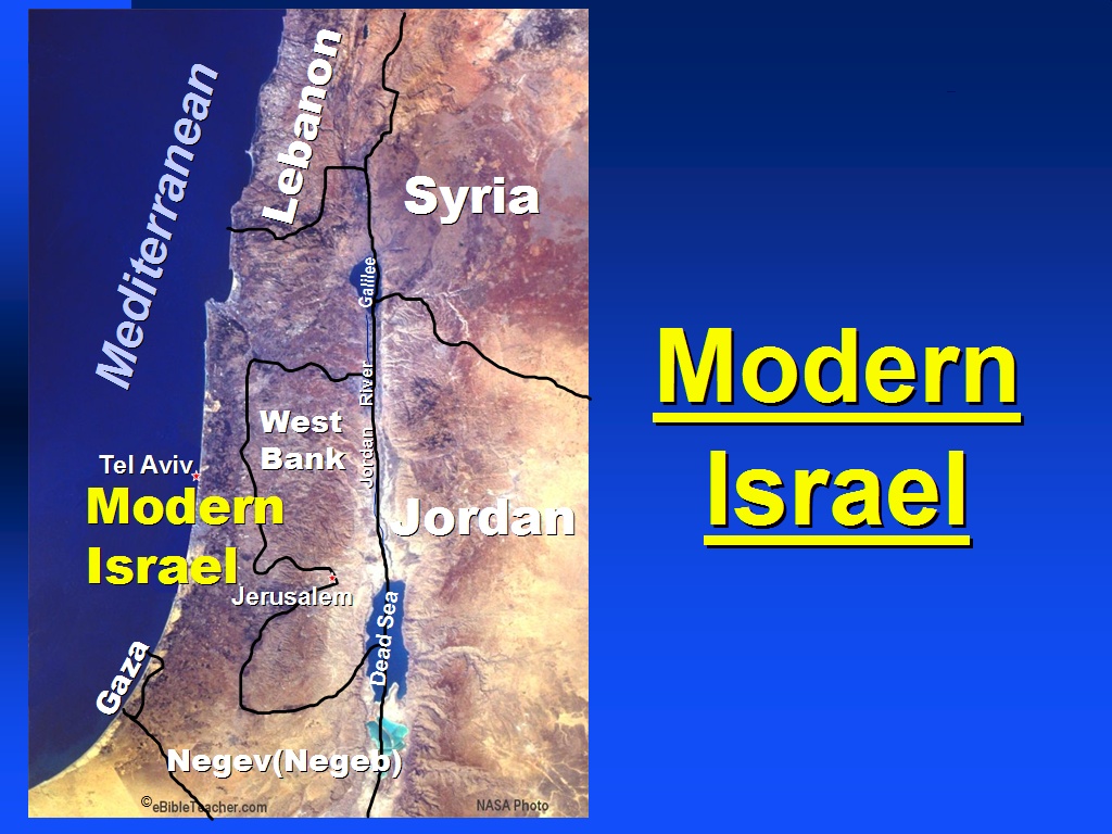 |
Modern Israel Keywords: Israel Source: NASA |